





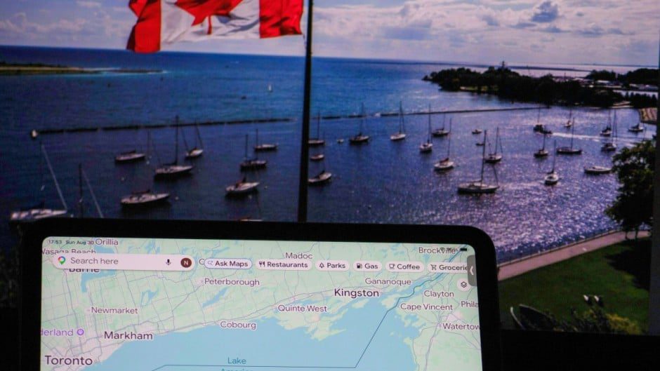
This change rolled out around August 29–30, 2026, following an executive order by U.S. President Donald Trump (signed around August 27) that directed the renaming of Lake Ontario to “Lake America” in official U.S. geographic records. The order updated the U.S. Geographic Names Information System (GNIS), the federal database that sets standards for official U.S. maps and place names. Google stated that it follows official government sources for geographic names and applies location-based labeling for features with differing national names.
How the labeling works on Google Maps
- U.S. users: See “Lake America.”
- Canadian users: Continue to see “Lake Ontario.”
- Users elsewhere: Typically see both, often rendered as “Lake Ontario (Lake America)” or similar dual labeling.
Google described this as consistent with its long-standing policy for bodies of water (or other features) whose official names vary by country. The company applied a comparable approach in 2025 when the Gulf of Mexico was renamed the “Gulf of America” in U.S. records and appeared that way for U.S. Google Maps users.
The rename does not alter Canadian naming conventions, international usage, or the physical geography of the lake (the smallest of the five Great Lakes, shared along the U.S.–Canada border, primarily bordering New York on the U.S. side and Ontario on the Canadian side). The traditional name “Ontario” has deep roots, deriving from Indigenous (Wendat/Iroquoian) terms such as Ontari’io or related words often translated as “beautiful lake,” “big lake,” or “lake of shining waters,” in use for centuries.
Context and reactions
The executive order occurred amid an escalating trade dispute between the United States and Canada involving reciprocal tariffs on billions of dollars in goods. Trump framed the rename in “America First” terms, describing the lake as an integral American asset tied to early trade, commerce, and economic resources. Canadian leaders rejected it outright. Prime Minister Mark Carney emphasized the name’s centuries-old Indigenous origin, predating both Canadian Confederation and the U.S. Declaration of Independence, and stated that Canadians would continue calling it Lake Ontario “then, now and always.” Ontario Premier Doug Ford called the move “absolutely backwards” or compared it to a “Saturday Night Live” skit, and Canadian authorities installed large signs along the shoreline reading “Lake Ontario. Now and Always.” Some U.S. officials, including New York Governor Kathy Hochul, also indicated they would not adopt the new name.
Other mapping services have not uniformly followed Google’s approach. As of late August 2026 reporting, Apple Maps continued to show “Lake Ontario.” MapQuest publicly declined to change the name and even offered a playful name-generator tool for users to invent alternatives. Some Canadian government and related websites (e.g., certain provincial agency pages that embed Google Maps data, including reports involving Metrolinx, Hydro One, LCBO, and others) temporarily displayed “Lake America” due to the data feed; officials said they were reviewing and correcting those instances to restore “Lake Ontario.”
Broader implications and nuances
This episode highlights how digital maps can reflect (and sometimes amplify) national political decisions on nomenclature for shared or border-spanning features. It creates a split visual reality depending on a user’s location or VPN settings, which can affect search results, navigation, tourism materials, educational tools, and everyday perception. Precedents exist for disputed or dual naming of geographic features (e.g., historical cases involving seas, mountains, or islands), but applying it to a well-established Great Lake name via executive action tied to trade tensions is unusual and has generated significant online mockery, memes, and late-night commentary alongside more serious diplomatic friction.
In practical terms:
- The change is limited to U.S. official databases and services that mirror them; it has no legal force over Canadian territory, waters, or records.
- International usage, scientific literature, navigation charts used by shipping, and most non-U.S. references continue with “Lake Ontario.”
- Edge cases include websites or apps that pull Google Maps tiles or data without location-aware overrides, temporary display inconsistencies during rollout, and potential longer-term effects if other U.S. agencies, textbooks, or commercial products adopt the GNIS update.
The episode is recent (late August 2026) and sits at the intersection of geography, politics, technology policy, and bilateral relations. Coverage from outlets including Reuters, AP, The New York Times, and others consistently reports the same core facts about Google’s location-dependent labeling and the underlying executive action.